2D mapping techniques based on geostatistics, and artificial intelligence to estimate rock properties and well performance distribution.


Features:
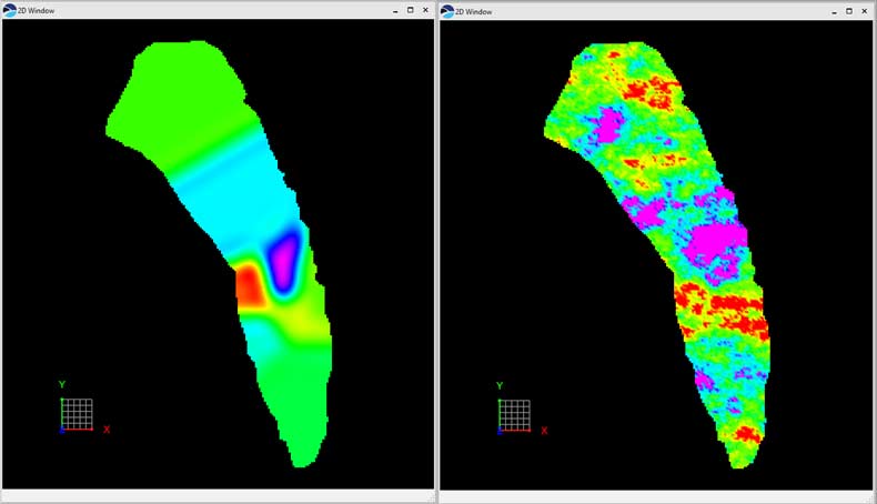
MapPredictor™ uses limited 2D well data to create geologic maps and 2D grids of key properties such as curvature, distance to faults, average reservoir porosity, and brittleness which can be correlated to EUR and other well performance proxies over large areas. Many interpolation methods are available: deterministic, stochastic and neural network for 2D modeling. Utilities for contouring a faulted surface in a map window, fault polygon editing, horizontal variogram, and anisotropy modeling are available.
- Creates surface or 2D grid from available point sets or well tops
- Supports fault polygon constraint, well adjustment, deterministic and stochastic interpolation methods. (geostatistics and neural networks)
- Interpolates available reservoir properties in a created 2D grid.
- Correlates multiple reservoir property maps with available EUR or a production indicator for sweet spot identification using neural networks